 ">
">
My Benton MacKaye Trail Summary
After 20 days hiking the remote, wild, rugged Benton MacKaye Trail we emerged from the woods into the picnic area at Big Creek Campground in North Carolina. Unlike doing an Appalachian Trail thru hike, there is no big finish or celebration here. There is no sign to show off your achievement to others – in fact, 99.9% of people have no idea what you’ve just accomplished and often asked us “what, you’re not going all the way to Maine?” When we ran across the large steel bridge on Baxter Creek to the trail sign at Big Creek, I whipped out my homemade “DONE!” sign I made on a spare guidebook page and we hunted down someone to take our photo. There was no fanfare. It was a fitting end to a hike that also really had no fanfare. Here’s a summary of what you can expect by hiking the Benton MacKaye Trail.
The southern terminus of the Benton MacKaye Trail – 0.2 miles from Springer Mountain.
When we drove the 4 hours from my parent’s house in Tennessee to Springer Mountain in Georgia it was a trip that brought back a lot of memories. We drove through our first resupply town of Blue Ridge, Georgia and past some BMT trail heads before finally making it to Springer. My dad climbed the mountain with us and we took obligatory photos, wrote in the log book, and then walked the 0.2 miles to the official beginning of the BMT. We said our goodbyes and then headed off into the north Georgia woods. On our first day, we only saw other hikers at times when the AT and BMT crossed, a total of five times including sharing a 1-mile segment with the AT at Long Branch Falls. Hiking the BMT in Georgia was very similar to the hiking we did in 2012 on the AT – it was 95 degrees and the humidity hovered between 90-99% the entire time we were there. NoKey took a few days to get his trail legs like many Georgia thru hikers, but we were lucky in that we had a much shorter learning curve with our gear packing and setup/breakdowns.
The Georgia section of the BMT was definitely interesting! We crossed developed roads with very little traffic the first few days. On our third day we had a very long road walk in the late afternoon sun and 95-degree temperatures that turned our day into an 18.7 mile trek since you can’t camp on the road! Since the BMT is not a National Scenic Trail, much of the land is encroached by private homes, many large and obnoxious vacation cabins. At one point our road walking took us through people’s driveways and yards! Coincidentally, this is the only place we really saw wildlife on the entire trail – a bear and two coyote – only feet away from vacation rentals. We also saw two boar and two deer. Georgia was the only place we saw any wildlife other than birds, chipmunks, and small snakes.
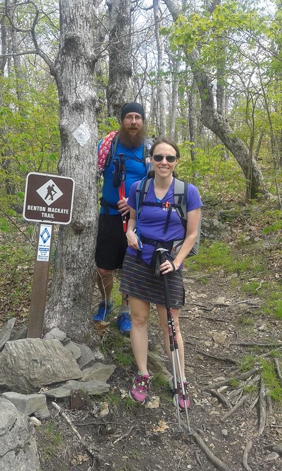
We crossed into Tennessee on day 7 and hit 100 miles on the trail the next day. The first 100 miles were hot, but very well-maintained. This second 100 miles on our trip I called “The Terrible Two’s” because they were like a mean little toddler – they scratched and bit and threw a tantrum! This second 100 mile stretch walks through a lot of Wilderness area, where maintenance is at a minimum and blazes are nonexistent! A good map and some compass skills got us through, but not without lots of blood, sweat, and a few tears. We noticed certain forests were better than others and it was definitely easy to tell when we crossed state lines. Tennessee wild lands were in much better shape overall than the North Carolina counterparts. The Cherokee National Forest lands looked like a disaster zone with trees down, blazes absent, and brush up to my shoulders. Reroutes of the trail were hard to find in this area as trails are only numbered, not named, and signs don’t reflect changes. When we left Tennessee for good and crossed into Slickrock Wilderness we were met by a tough trail with a swift and deep creek crossings before being deposited out onto US-129, commonly referred to as The Dragon – where car and motorcycle enthusiasts come to drive the more than 300 curves in 11 miles. We stumbled bloody, wet, and exhausted the half-mile road walk to the historic Tapoco Lodge and our entire hike changed from this moment.

This is how trails are signed in the wilderness – follow your number!
After an amazing stay at Tapoco Lodge, we were ready for the part of the BMT I was looking forward to the most, The Smokies! I learned how to hike in this park. I grew up only mere miles away and didn’t step foot on a hiking trail until I was in my early 20s. I know every trail in this park, having hiked them all, and I know all the history. For me, this represented more than the end of our journey… it represented coming home.

The Smokies – my “stomping ground”. This is the park where I learned how to hike! I’m home!
When we reached the Smokies I learned I had made a mistake in calculating our trip. Memorial Day weekend was beginning just as we entered the park. We had camped alone every single night on the trail at this point and now here we were in the Smokies on the first official weekend of summer. We saw more people on our first day in the park than we had our entire trip to this point! This also poses a problem for permits, which you need to backpack in The Smokies. BMT hikers cannot just get a thru hiking permit like the AT hikers can. Logistically trying to plan which campsites we could hike to and getting reservations was pretty obnoxious the night before we walked into the park. While the park was busy, every trail we walked was clear and free from blowdown/brush/briars. Our days of bleeding and beat downs were over!

This is a tunnel you walk through on the “Road to Nowhere” in North Carolina. After building 10 miles of road and this tunnel, the government scrapped the road project, breaking a promise to the hundreds of families kicked off their land during WWII.
We camped with some really great people during our time in the park – a rehabilitation group for young men, school teachers, families hiking with three generations, young people who live out on the trails. It was nice to be socializing again since it was pretty much just the two of us the entire hike. Our last night on trail we had a total of 12 people camping at Laurel Gap Shelter, the only shelter we got the opportunity to camp in on the trail. We got very lucky and as we hit the highest point on the BMT at Mt. Sterling, at 5826 feet, we had an epic 360-degree view from the fire tower. When we reached the end of the trail in the early afternoon of day 20 we were happy and proud of our accomplishment.
If you have any questions about our statistics from the Benton MacKaye Trail, feel free to check out my blog posts on my personal blog. The Benton MacKaye Trail Association was incredibly helpful – from guidebooks to trail condition updates – and we are grateful for their hard work! If you want to see more photos from our trip, check out my Benton MacKaye album over on my Facebook page! I’d love to chat with anyone looking for more info about this rugged and challenging little sister trail to the AT.

This website contains affiliate links, which means The Trek may receive a percentage of any product or service you purchase using the links in the articles or advertisements. The buyer pays the same price as they would otherwise, and your purchase helps to support The Trek's ongoing goal to serve you quality backpacking advice and information. Thanks for your support!
To learn more, please visit the About This Site page.

Comments 1
Thank you for this summary! So helpful. In early April I’m going to thru hike the BMT NOBO with two friends from my 2021 Colorado Trail thru hike. I’m 64 and not nearly as fit as you so it’ll take longer. I’m wondering about the best resupply and zero options. I’m getting the BMTA thru hike guidebook and expect it’ll have some answers.